
Although it was shown at CES last month, at PMA this week it was our first opportunity to see Casio's prototype GPS-enabled compact camera, which Casio calls a Hybrid GPS camera. Looking very similar to a Casio Exilim EX-H10, but with an expanded top-section, the prototype Casio Hybrid GPS camera is called 'hybrid' because the camera doesn't just rely on a GPS (Global Positioning Satellite) receiver to maintain tabs on its position. Casio has built a GPS system for its camera that is supplemented by an inertial positioning system.
The GPS receiver works to establish and track its position accurately, outside when there is a clear view of the sky. But when the sky becomes partially or totally obscured so GPS satellites can't be seen by the receiver reliably any more, or buildings cause reflections of the GPS satellite transmissions that introduce errors, three dimensional motion sensors inside the camera can take over the task of tracking the camera's position. Casio's very brief information about the Hybrid GPS camera does mention motion sensors, and it's likely that a combination of solid state accelerometers and gyro sensors amount to the 'motion sensors'.

This view on the LCD screen of the Casio Hybrid GPS digital camera demonstrates the map view with a place selected and along the right are thumbnails of images photographed there. In this case it's a place depicting the Colombian river in South America.
Both types of motion sensor have been used in cameras already; accelerometers are used in image stabilisation systems, and gyro sensors are used for digital levels found in some digital camera models. Accelerometers can measure motion in a linear form, while gyros measure rotational motion. Compute the two together and you can work out where the camera is going. It's not as precise as GPS, but it's very handy for when the GPS signal is temporarily ineffective. And as Casio point out, inertial positioning means the camera will be able to maintain a fairly good idea you are inside a building or under ground, perhaps in a cave or a tunnel. Inertial navigation systems are nothing new, but Casio has to be congratulated for appearing to be the first to have implemented it in compact digital camera.
Until now digital cameras with a GPS facility have only served a fairly simple task of geo-tagging, or recording the position coordinates of the camera when a picture is taken. Casio's Hybrid GPS camera goes well beyond geo-tagging. A world map database is stored in the camera, so you can see on the camera's LCD screen where you are, just as if you were using a generic hand-held GPS unit for walking or hiking.

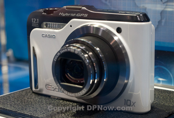
The additional motion sensing and GPS hardware requires a little extra space on the top of the camera.
You can mark positions you are at on the map and use them as reference points, although there is no route or direction planning facility as in a car satnav. The Casio map database also includes key points of interest (POIs), which are interesting or useful places, including tourist spots, and other sites of interest. You can also add your own POIs illustrated with pictures you took at these positions.
I wasn't quite sure if Casio has plans to make its motion sensors work as a digital compass, but this would make the system even more attractive, enabling you to not only reference where you took the picture, but in which direction you were facing at the time you pressed the shutter release.

The Casio Hybrid GPS camera prototype looks remarkably finished and that hopefully means it will be on sale sooner rather than later.
Casio staff on the PMA booth remained coy about plans for producing their Hybrid GPS camera. Personally, I can't wait to get my hands on one.
Reader feedback:
Discuss this story:


